LandPKS Soil ID helps users to identify soils. This document gives a high-level description of how the Soil ID Algorithm works. This article in the Soil Science Society of America offers a more technical explanation.
Overview
There are tens of thousands of types of soils in the world. To help identify which one is present at a site, LandPKS Soil ID compares a user’s observations about the site with the soils mapped in the area. The more observations entered into the app, the more accurately LandPKS can compare and rank the soils.
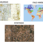
Soil Maps
In the United States and U.S. territories, the Soil ID algorithm uses SoilWeb to pull information from SSURGO. When SSURGO is unavailable, STATSGO will be used as a fallback.
Outside of the U.S., Soil ID uses FAO Harmonized World Soils Database.
Learn more about the soil maps used by the Soil ID algorithm.
Algorithm process
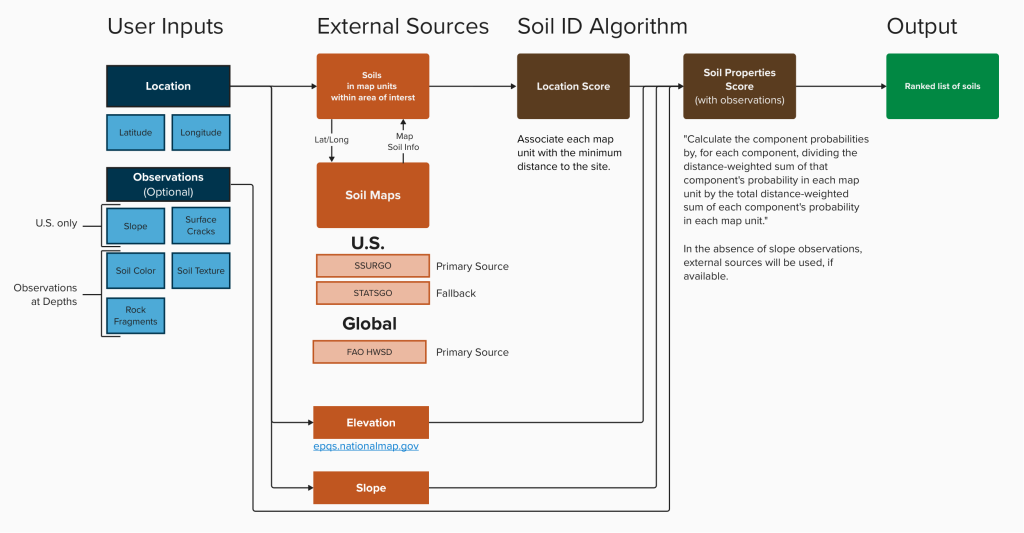
Location Score
The LandPKS Soil ID algorithm uses the latitude and longitude of the site and creates an area of interest around it. In the U.S., the area of interest is a circle 1km from the site. Outside the U.S., the area of interest is a circle 30 km from the site.
The algorithm then pulls from the soil map the list of possible soils within the area of interest, and scores each soil according to:
- how close the soil is to the site (whether it is in the site’s map unit or in a nearby unit), and
- the proportion of the map unit made up by the soil.
Soil ID then displays the top soil matches: up to 12 soils with the highest location scores.

Soil Properties Score
When the recommended observations are added, they are compared with profiles of soils in the top soil matches list. The soils receive soil property scores based on the similarity of the properties of each soil to the observations entered into the app.
Relevant properties
| Input | Used by U.S. algorithm | Used by Global algorithm |
| Slope Steepness | Yes | No |
| Surface Cracks | Yes | Yes |
| Color (at depths) | Yes | Yes |
| Texture (at depths) | Yes | Yes |
| Rock Fragmentation (at depths) | Yes | Yes |
| Bedrock Depth | Yes | Yes |
Total Score
Soils are then ranked by a combination of location score and soil properties score. The Top Soil Matches list will automatically update the re-ranked soils as observations are entered.
While Soil ID does not require the user to enter all the observations listed, it is highly recommended to do so. Each observation helps refine the soil properties score and improves the accuracy of the soil ranks.
Note: the Soil ID algorithm currently only works online. If you enter observations while offline, the Top Soil Matches list will re-rank when you come back online. When possible, it can be helpful to create a site before heading out to the field to pull the initial list of Top Soil Matches.