Skip to content
LandPKS Soil ID
  • About
    • About LandPKS
    • Beta Program
  • Articles & Resources
  • News
  • Data Portal
  • Help

Getting Started: How to Identify Soils Using LandPKS Soil ID

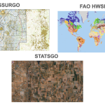
LandPKS Soil ID helps you identify soils by gathering a few key soil observations and comparing them to matches from soil maps. Watch this 5 minute video to explain the process.

For more detail, read about the Soil ID Algorithm.

Topics

Case Studies
Intro Series
Research Papers
Soil Observations
Soil ID
Training Materials

Recent Articles & Resources

  • Getting Started: How to Identify Soils Using LandPKS Soil ID

  • LandPKS Soil ID logo, with the words "How to measure soil texture" above a picture of a phone and a hand making a soil ribbon

    How to measure soil texture (with video)

  • Professor Dmytruk and his students digging a pit to assess the soil properties and determine soil identification using LandPKS Soil ID in Ukraine.

    Healing Ukraine’s Soils: LandPKS Supports Agricultural Recovery Through International Collaboration

  • A display of Soil Maps, Including SSURGO, STATSGO, and FAO HWSD

    Soil Maps used by LandPKS

  • Cover image for Ukrainian Translation of the LandPKS Soil ID App User Guide

    КЕРІВНИЦТВО З ОПИСУ ГРУНТІВ З ВИКОРИСТАННЯМ МОБІЛЬНОГО ЗАСТОСУНКУ LandPKS Soil ID

Contact Us

General Inquiries Support
Tech Matters - Powering Systems Change - logo, link to techmatters.org
Terraso logo, link to terraso.org

© Copyright 2026 Tech Matters | Privacy Policy

Subscribe for News and Updates

Stay informed about LandPKS apps, including opportunities to provide input on features, and other news. Our newsletters are infrequent, and we will never sell or share your personal information.